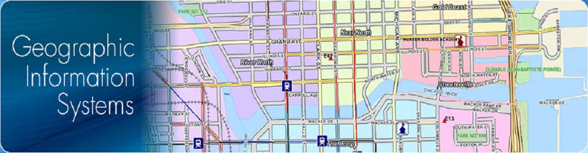
Urban & Land Management
MMI INFOTECH has the capability to deliver a complete GIS solution for urban planning. GIS broadly explain as a formalized computer based information system which is capable of integrating data from various sources to provide the information necessary for effective decision making in urban planning. MMI INFOTECH is also expert in creating a database oriented GIS where spatial and textual data can be stored and linked using geo-relational model.
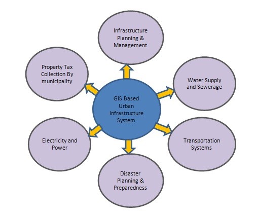
MMI INFOTECH has clear understanding of Database management, visualization, spatial analysis, and spatial modeling which are the main uses of GIS in urban planning. Model depicting GIS and Urban Planning system is shown below:
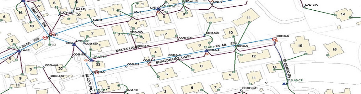
MMI INFOTECH has the capability to deliver a complete GIS solution for urban planning. GIS broadly explain as a formalized computer based information system which is capable of integrating data from various sources to provide the information necessary for effective decision making in urban planning. MMI INFOTECH is also expert in creating a database oriented GIS where spatial and textual data can be stored and linked using geo-relational model.
MMI INFOTECH has clear understanding of Database management, visualization, spatial analysis, and spatial modeling which are the main uses of GIS in urban planning. Model depicting GIS and Urban Planning system is shown below:
The more routine general administration and development control work of urban planning using GIS includes:
• Management of land use records;
• Thematic mapping;
• Planning application processing;
• Building control application processing;
• Land use management;
• Land availability and development monitoring; industrial, commercial, and retail floor space recording;
• Recreational and countryside facility planning;
• Environmental impact assessment;
• Land use/transport strategic planning;
• Public facilities and shops catchment area and accessibility analysis.
Services

Copyright © 2015 - All Rights Reserved - MMI Infotech